Fier
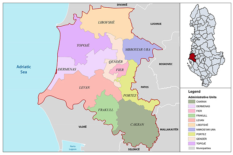
The Municipality of Fier is situated in the Western Lowlands of Albania, between the Seman and Vlora rivers, covering a surface of 619.9 km2. The overwhelming majority of the new Municipality lies in lowland areas, while the Çakran and Frakull units have a more hilly territory. After the administrative reform Fier municipality consists of ten administrative units: Fier, Cakran, Mbrostar Bridge, Libofsha, Center, Dimenas, Topoj, Levan, Frrakull and Portėz. The municipality has under its administration one city and 85 villages. According to the civil registry for 2016, the municipality has a population of 200,376 inhabitants. The new municipality has a considerable river coastline, from the mouth of Vjosa River to the mouth of Seman River at the borders of the Divjakë-Karavasta National Park, part of which is also the archaeological park of Apollonia, in addition to other cultural heritage objects. Furthermore, Fier Municipality includes the country's most important agricultural areas, as well as a significant part of the oil-related industry. The agricultural production of this area is diverse and includes grains, vegetables, vineyards, livestock and its byproducts.
